Latest Drafts
2001 May
Technical material on the data model is now available at the ESRI web site,
http://arconline.esri.com/arconline/datamodels.cfm
2001 March
Our most recent activity has been at the nuts and bolts level, linking
UNETRANS to Arc8.1 connecting the shell to the chassis, so to speak.
There's been some back and forth as a result, hence the prolonged silence
from our end. The packages are now quite different from what we presented
in Redlands last December, and we invite your comment once more.
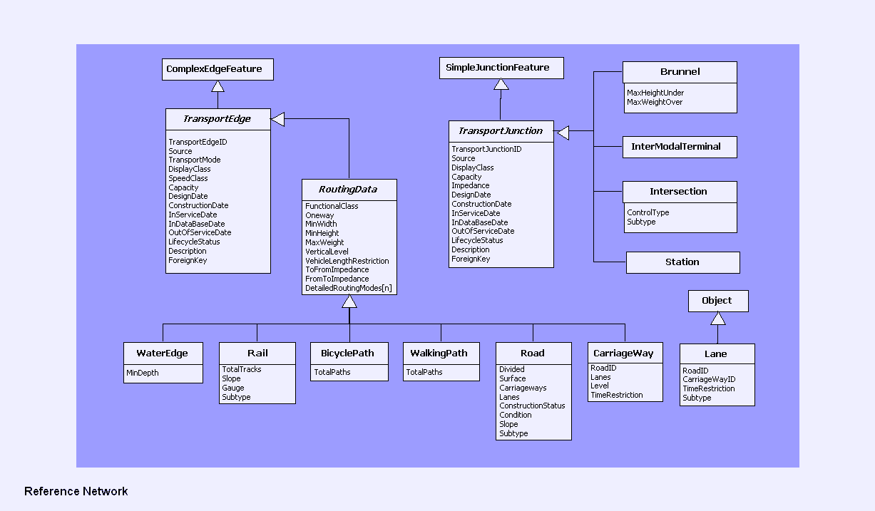
Reference network
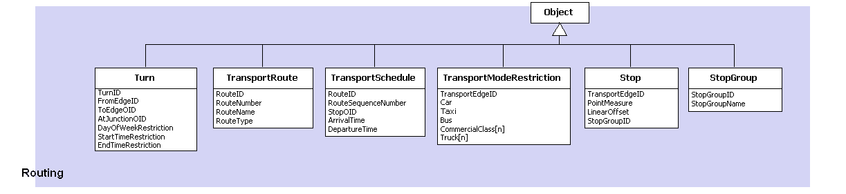
Routing
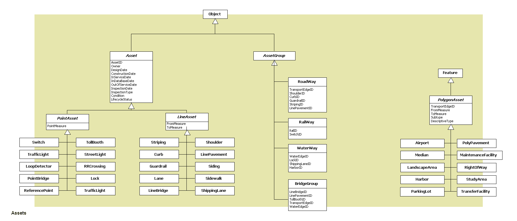
Assets
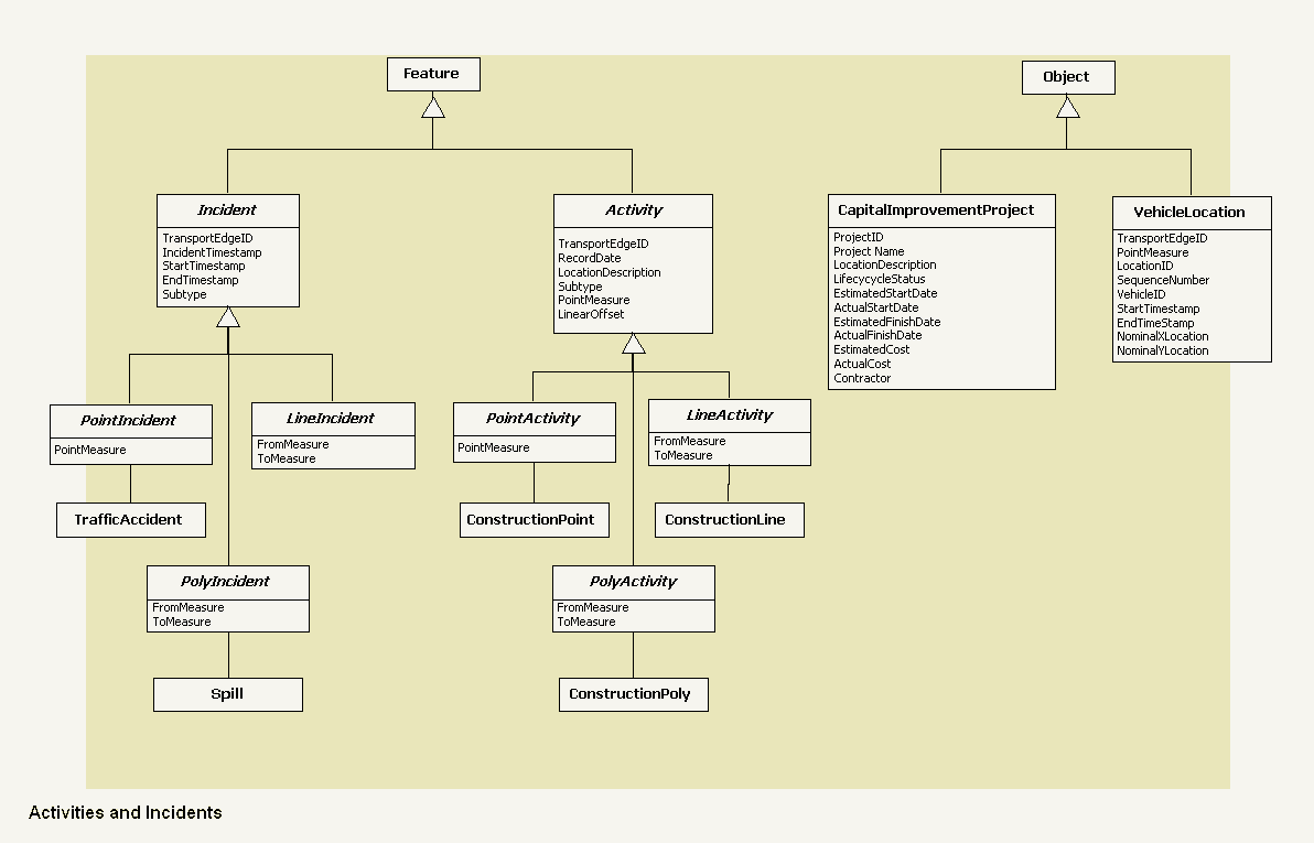
Activities & incidents
Mobile objects
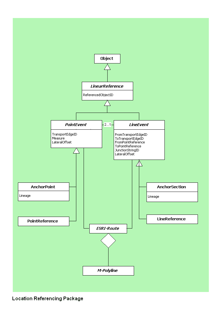
Linear referencing
Q: Why are these separate units? Don't they link together at
some point?
A: The Arc8 geodatabase is the umbrella under which these exist.
The hooks are Arc8 Network Features and Objects.
Earlier Drafts
Round 4 (2000 December, Redlands)
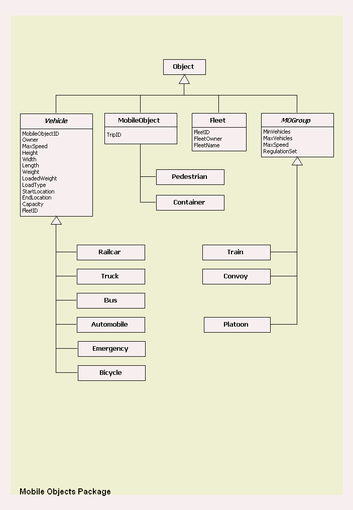
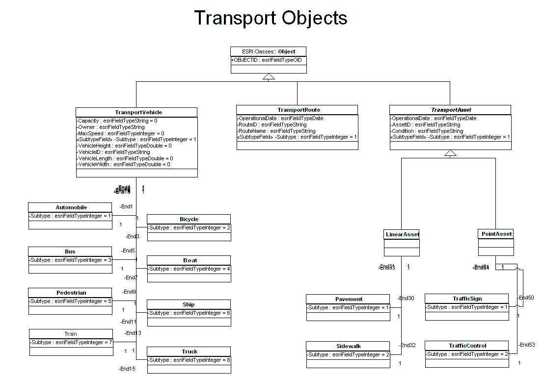
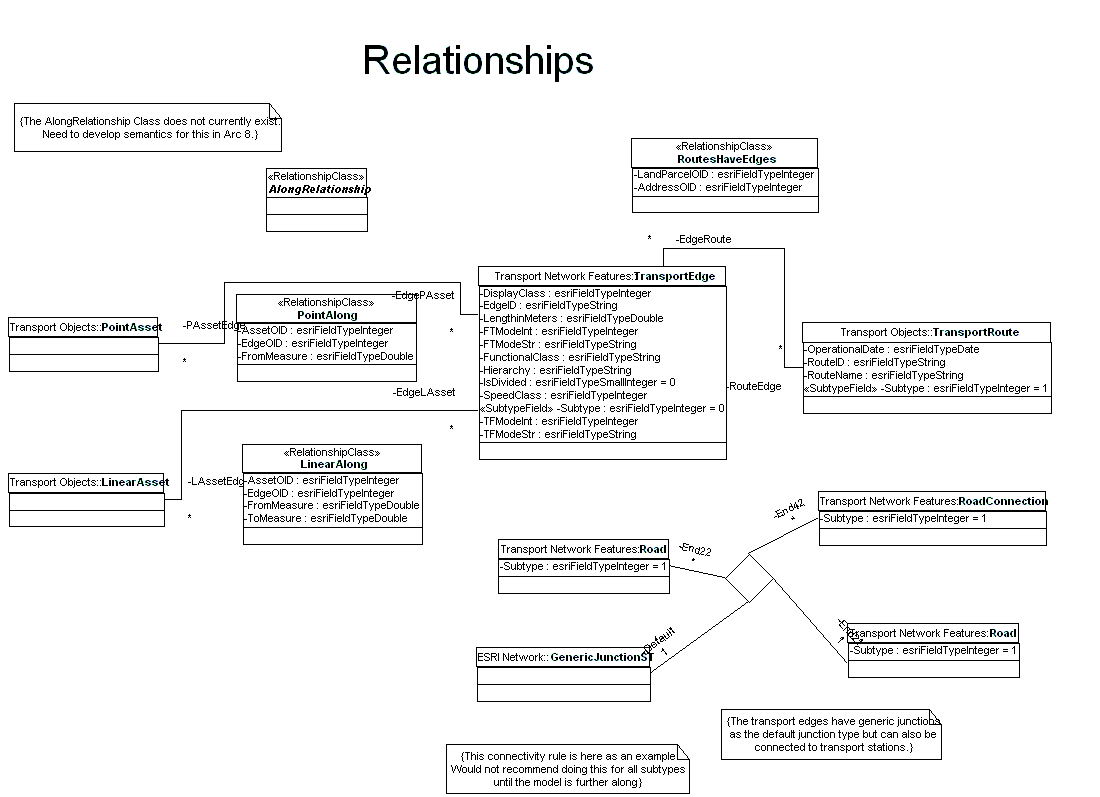
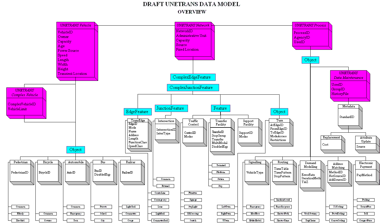
At the highest level, the model consists of 4 packages:
-
transportation infrastructure navigable objects
-
assets
-
vehicles
-
business processes
Supporting packages deal with locators (including linear referencing),
relationships and interfaces (collections of methods). The best place
to look for this draft is under the Redlands consultation comments on
the drafts are also available there.
Round 3 (2000 October)
In the third round we have unified the first two approaches, and implemented
the model on a small test data set.
-
Data model objects and processes:
exhaustive list of entities and processes
-
Data model: principal elements
only
-
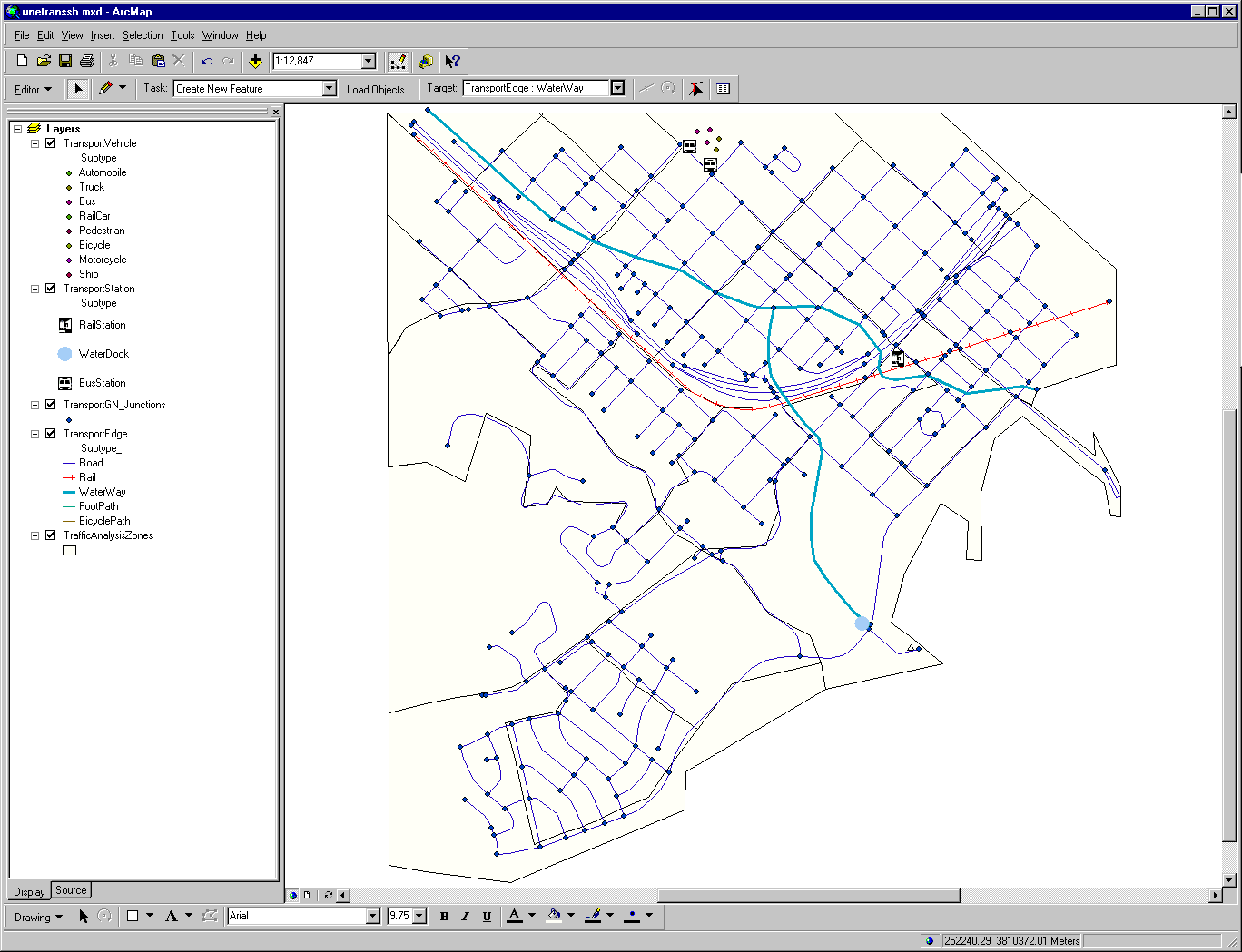
We have developed a small database for part of Santa Barbara, for test
implementation. This screen shot
shows various transportation entities in multiple modes.
Round 2 (2000 September)
Over the last few months we have been gathering data models, requirements,
feature descriptions, transportation entity labels, use cases and nightmare
pathologies (difficult to model) from various users and previous efforts,
including
-
ESRI StreetMap
-
GDF
-
GeoNET (Dueker-Butler)
-
NCGIA publications 96-3 and 94-6
-
NCHRP 20-27(2) reports #218 and #221
-
NSDI Framework Transportation Feature Identification Standard
-
Pavement Management Model
-
TOPS
-
TLOS
The first round was top-down construction of the model, considering the
major entities and operations. The second round was bottom-up, starting
with the principal entities, objects, labels, spatial and operational relationships.
Round 1 (2000 August)
This is a conceptual overview that unifies the components that follow.
It was the first piece developed, and you'll find instances where the components
differ from it. In those cases the components reflect more recent
thinking, and take precedence.
How You Can Help
To make the model most useful to a broad range of user needs, we're now
looking for your contributions and feedback in the following areas:
-
Application storyboards and scenarios details on how you currently use
(or would like to use) transportation data in specific applications, from
data capture to output and decision.
-
Difficult pathological cases nightmare topologies that seem impossible
to model (e.g. divided urban roads with parallel service roads and slip
lanes linking them, prohibited turns, etc).
-
Critique of the model above try to capture your local geography using
the model.
-
Participation in the forum