- VEHICLE
INTELLIGENCE & TRANSPORTATION ANALYSIS LABORATORY
University of California, Santa Barbara
![]()

University of California, Santa Barbara
|
|
| What is ITS? | Scenario
1: It's a foggy Friday night. John and Jane Doe are driving down
a remote mountain track. An errant deer (no relation to the Does)
steps out of the bush. The driver loses control, and the vehicle
rolls down the cliff. It could be a long time before the Does get
help.
Fortunately the Does have an intelligent vehicle. An array of sensors note that the air bags have deployed, that there have been sudden changes in velocity and orientation. The vehicle emits a digital mayday to the nearest 911 center, with details on the situation and a precise location reading. Scenario 2: You're on your way to an important meeting. Traffic is backing up on the Interstate. There's an alternate local route, but is it likely to be any better? You consult the dashboard computer. Using a Global Positioning System (GPS), it updates your location on a map every couple of seconds. It is in touch with the Traffic Management Center (TMC) that monitors highway speeds. It works out likely arrival times based on the latest observations: 11.24 a.m. using the local route, 11.47 a.m. along the Interstate. This is the arena of Intelligent Transportation Systems (ITS). ITS can be applied to a variety of problems such as toll collection, fleet management, collision avoidance and autonomous control, tracking of weapons and hazchems in transit, coordination of transit schedules, and traveler information (e.g. where's the nearest motel with an available room). The ITS infrastructure a high-tech dream that is gradually becoming reality consists of a network of information exchange points including the intelligent vehicle, Emergency Management Services (EMS), TMCs and other Information Service Providers (ISPs), Electronic Toll and Traffic Management (ETTM) systems, roadside beacons and communications systems. |
|
|||||||
The
|
The
scenarios presented above are being tested by government and industry players
in North America, Europe, Japan and Australia. Before they become part
of our everyday life, some standards issues need to be resolved.
A TMC broadcasts information on congestion, i.e. at such-and-such place the average velocity is so-and-so. Velocity is straightforward, but how does it describe the location of this observation? There are two aspects of interoperability: First, no two vendors' digital maps of the same area are identical in all respects. Positional disagreement ranges from 0 to 150 metres. Hence a location could be specified very precisely with respect to one map base, but when transferred to another vendor's map it could be off by a block. Second, there are several ways of describing a location, for example:
Here's one problem scenario: Three vendors, A, B, and C, offer databases for Santa Barbara county. The TMC adopts Vendor A, and broadcasts congestion data based on it. The Motor Club is based on Vendor B's map. A poor traveler has Vendor C's database on CD-ROM in his dashboard computer. He requests motel information from the Motor Club. When the data comes in and gets mapped on his system, his motel appears to be in the middle of a lake. He asks for congestion data from the TMC. It gets attached to the wrong network link because of coordinate misregistration. The navigation system recommends a bizarre route to a lakefront. This is perhaps forgivable for someone looking for a motel, but not for an ambulance on an emergency call. |
 |
|||||||
| Solutions? | Initiatives
at the international level (International Organization of Standards, ISO,
TC204) and the national level in the U.S. (Society of Automobile Engineers,
SAE, Recommended Practice J2256) and Japan (Vehicle Information
and Communication System, VICS; Universal Traffic Management System,
UTMS) have addressed the issue of messaging protocols. They
describe the makeup of various messages and the information fields that
should be associated with each. For example, a "Position Report from
Road Side Beacon" is composed as follows (ISO Draft Recommended Practice,
Version 1.3):
|
 |
|||||||
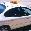
| VITAL's Role | VITAL
has vehicles in two-way communications with ground-based data servers in
Santa Barbara. The vehicles carry position sensors and precise odometers.
A selection of popular commercial data bases are installed in the servers
and mobile units, and messages are exchanged between servers and vehicles.
Errors are systematically studied, and remedial measures evaluated.
We address issues of interest to industry and academia, for example:
These efforts will help future ITS planning, shorten travel times, improve highway utilization, and perhaps save the Does and their deer friends. |
. |
|||||||
Further
|
ITS
User Services as defined in National ITS Architecture
ITS Glossary (with links to some ITS organizations) |